
Kent Ramblers Walk 35
Distance: 7.1 Miles (3hr 30m)
OS Map: Explorer 136 (Start at grid reference TQ656418)
Park in parking area at westernmost corner of Matfield village green.
Take track to right of sports pavilion. At end of fence on right, take path through gate between fences. After 140 metres go over stile on left and bear right across field to electricity pole. Go through small strip of scrub, cross another field diagonally downhill and go through a stretch of woodland. Cross narrow meadow to Bramble Reed Lane. Turn right for 45 metres and take path on left climbing through woodland (fine wood anemones and bluebells in spring) then bearing left along right hand edge of orchard (first hazel nuts then apples). At track, turn right to Romford Road.
Turn left along road for 210 metres to start of woodland on right and take path on right along left hand edge of orchard to electricity pole. Take track on left through woodland following powerlines, descend to stream and climb to T-junction meeting the Tunbridge Wells Circular Walk (the fingerpost still bears its old name, High Weald Walk). Turn left for 350 metres and at junction of four paths turn right downhill along path indicated by waymarks on post.
Cross footbridge, bear right uphill to meet level path at T-junction and turn left. After 70 metres or so turn sharp right uphill. Keep going until the path starts to descend again and there is a derelict building close to the path on the right (and one on left too). Turn right immediately past the building and follow path between orchards for 460 metres.
At junction of paths by electricity pole turn sharp left and descend gently to Pippins farm. Bear left across farmyard and take driveway through orchards up to road. Go straight across and along drive towards Downingbury Farm shop (coffee, fruit and ice cream available). Bear right in front of shop then double back behind shop along path past pylon to bridge over A228. Immediately over bridge take path on left down steps. Cross top of field then bear right downhill. About halfway down go through gate on left then diagonally across field to another gate and down to Redwings Lane then left to Old Church Road.
Turn right down Old Church Road, pass water treatment plant then climb until Kent College comes into view. At first entrance to the College (Prep School) go through wooden gate to right of drive and across decking into field.
Cross field passing just to left of lone oak tree to stile. Cross next field just left of line of oak trees to another stile then continue in same direction across next field to a stile just right of electricity pole into wood.
Inside wood path should follow fence on left but may be unusable due to stream running along it. Take alternative path a few metres inside wood and keep left at all junctions eventually returning to fence on left. At gate turn right and soon bear right descend steps to stream and climb more steps on other side. Ignoring gate on left, continue just inside wood until you reach stile out into field. Follow right hand edge of field until, about two-thirds of way to corner, you come to stile on right. Climb stile and followleft hand edge of next field past pond on left to gate.
Through gate, follow left hand edge of orchard, crossing stile half way along. When left hand fence ceases, keep going straight forward until you reach far end of orchard. There should be gate in corner leading to next field – if it is not obvious, bear right until you find it. Cross top of field and skirt right hand edge of pond. Bear right past footpath sign into orchard then bear left towards house. Go between the house (on your left) and hedge (on your right) down to Amhurst Bank Road.
Take path opposite. Once inside the field go straight down the hill and look for a track through the bracken bearing slightly right near the bottom. This should lead you to a gate and then to a bridge across a stream. On the other side bear left across duckboards and into wood then follow path round to right. At far side of wood, go over stile on left and turn sharp right to follow right hand edge of next field uphill. When path bears right into next field, do not follow broad track between hedges but cross field diagonally uphill aiming just to right of house visible on horizon. In corner of field cross stile to A228 (Maidstone Road).
Cross road very carefully – it can be busy and you may have to be patient. You are aiming for path on opposite side of road just a few metres to right – it is easily visible. Follow this path past tennis court, through gate and then down track towards woodland. Go into woodland, across stream and up other side of valley to junction of paths.
Turn left and follow path through woodland, crossing footbridge at bottom, and up other side with no significant changes of direction. At top turn left along path inside the wood until you reach corner of wood. Go over stile on right just past corner and tune right along path that soon goes between fences downhill towards another wood. Across bridge climb to waymark post and take right fork through Kent Wildlife Trust reserve (a bit overgrown at time of writing). On leaving reserve go ahead uphill on track and follow it as it bears left along edge of wood. Keep going until path reaches tarred drive and turn right.On meeting Chestnut Lane, turn right and take second lane on right (Maycotts Lane) back to Matfield.

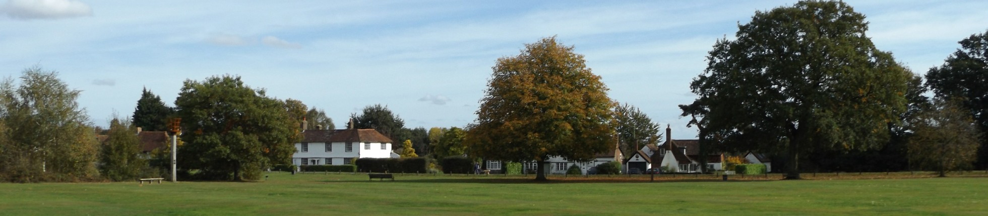
Matfield has the largest village green in Kent.
The beacon by the duck pond dates only from 2000; it was
lit for the millennium and again for the Queen's Golden
Jubilee in 2002. At its north end the green is
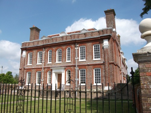
overlooked by the elegant Matfield House, built in 1728
in the Queen Anne style. The fine stable block is
topped by a splendid clock tower bearing the advice to
'mind the time'.
There are many other fine
weatherboarded and tile-hung houses around the green and
a pub at each end. The sports pavilion was
finished in 2014 after its predecessor was destroyed by
fire.The name derives from 'Matta feld' ' the large
clearing farmed by Matta.
Adjacent to Kent College and quite some way from Pembury which also has a newer church, old St Peter's was mainly built by John Colepepper of Bayhall in 1337 although some parts may date back to 1147 or earlier.
Kent College is an independent day and boarding school for girls.
Cinderhill Community Woodland consists of both
woodland and heathland – an increasingly rare
habitat in Kent. During the summer of 2021 the
heathland was grazed by Jacob sheep to help prevent the
heathland becoming scrub and eventually woodland.
The site is looked after by the Kent High Weald
Partnership with the help of volunteers. The name
is a reminder of the iron industry that was prevalent in
the area in Tudor times.
Automatically migrated from https://www.kentramblers.org.uk/KentWalks/public/walk_035.htm on 2025-12-11 09:19