Kent Ramblers: Walk 87

map 087

Kent Ramblers: Walk 87

Volunteer

One Tree Hill and Bitchet Green

Distance: 3.3 miles (1h 20m)

OS Map: Explorer 147 (Start at TQ558532)

Start from the car park at One Tree Hill.

Leave through gap in fence at top of car park past information board. Follow broad track to T-junction. Turn right downhill to lane.

Turn left and take path on right just a few metres along drive to Shepherds Meade. Follow path between fences (glorious bluebells in wood on right in spring) to junction. Turn right uphill through woodland to lane. Take path opposite through woodland to next lane.

Take path opposite, bearing initially right and left then gently descending and avoiding all side paths, down to a stream. On far side bear right uphill and left then take first distinct turn on right (there is an indistinct path just after the main path bears left and levels out and the correct turn is a few metres after that) through bracken to lane (where there is a finger post). Take short section of path opposite to next lane.

Go down driveway for Nether Fawke opposite, bearing right then left at end. Continue to farmyard and take path over stile at far left corner. Bear right around farm building to second stile then left downhill over third stile in corner of field and through band of trees into large field. Turn left along valley parallel with trees on left to a stile. Over stile continue downhill to valley bottom then up far other side, over stile and over yet another stile onto uphill path leading to track past house. At T-junction turn right along drive to lane.

Bear left across lane, along right-hand edge of triangular green and after 50 metres turn right along lane. Follow lane for around two thirds of a mile, then becoming a rough track and descending steeply. Immediately on reaching an asphalt track by Rooks Hill Cottage take path up bank into woodland on right. Follow path through woodland to re-enter National Trust land at One Tree Hill. There are many paths that will take you back to the car park but for a fine view keep left to reach stone seat. When rested cross track running a few metres behind seat, cross low bank and bear half left along track on far side of clearing back to car park.

Points of Interest

Sevenoaks Greensand Commons

					Project

The hatched areas on the map are common land. The Greensand ridge has a long history of human activity. The poor, acid soils meant that the post-glacial woodland was easy to clear but the cleared land very difficult to farm.
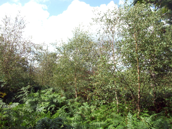
Instead lowland heath developed and was prevented by grazing animals from reverting to scrub and then woodland. However, in recent times grazing has reduced considerably and scrub was becoming widespread (picture above), putting at risk the rare lowland heath habitat. The Sevenoaks Greensand Commons Project was started in 2018 with lottery funding and has significantly increased local awareness and understanding of the history and ecology of the commons.
However, apart from some clearance of rhododendron and birch and some turning over of soil to expose seeds, it is not very clear what has actually been achieved on the ground. It seems that early aspirations of reintroducing grazing have come to nothing.

The Greensand ridge has been a useful route for communication since the Stone Age, providing dry ground in stark contrast with the muddy Wealden clays to the south and the Gault clay to the north. Bitchet Common lies between two iron age forts, Squerryes to the west (walk 12 in our 2022 Annual Review) and Oldbury Hill to the east (walk 10).

Public Transport

This walk is not conveniently accessible by public transport.

Automatically migrated from https://www.kentramblers.org.uk/KentWalks/public/walk_087.htm on 2025-12-11 08:56